Portfolio
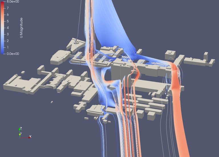
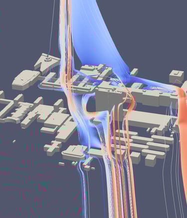
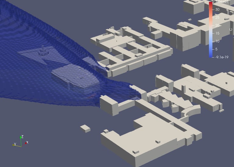
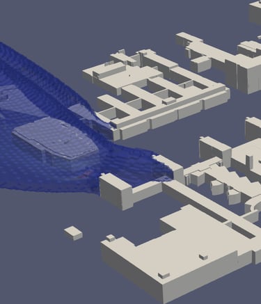
Urban Wind and Pollution Dispersion Modelling
Test, compare, and refine designs with evidence-based insights for better form and comfort.
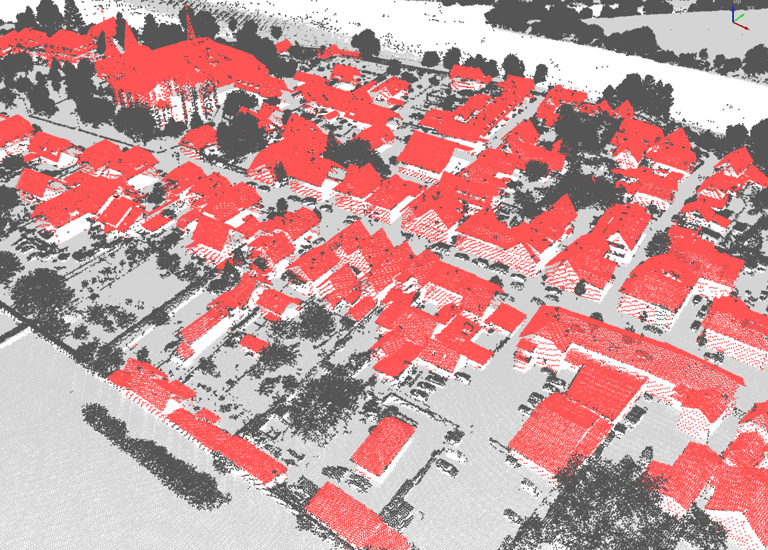
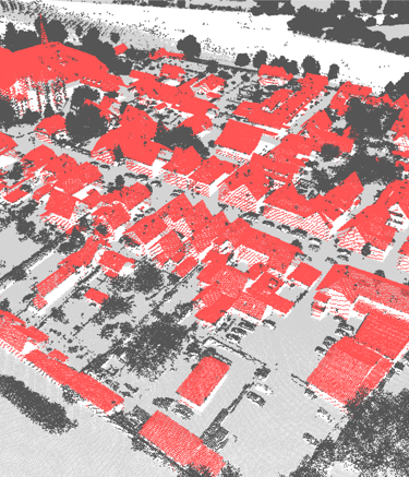
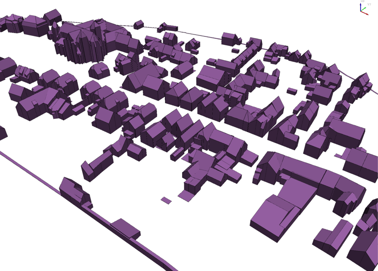
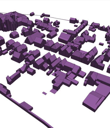
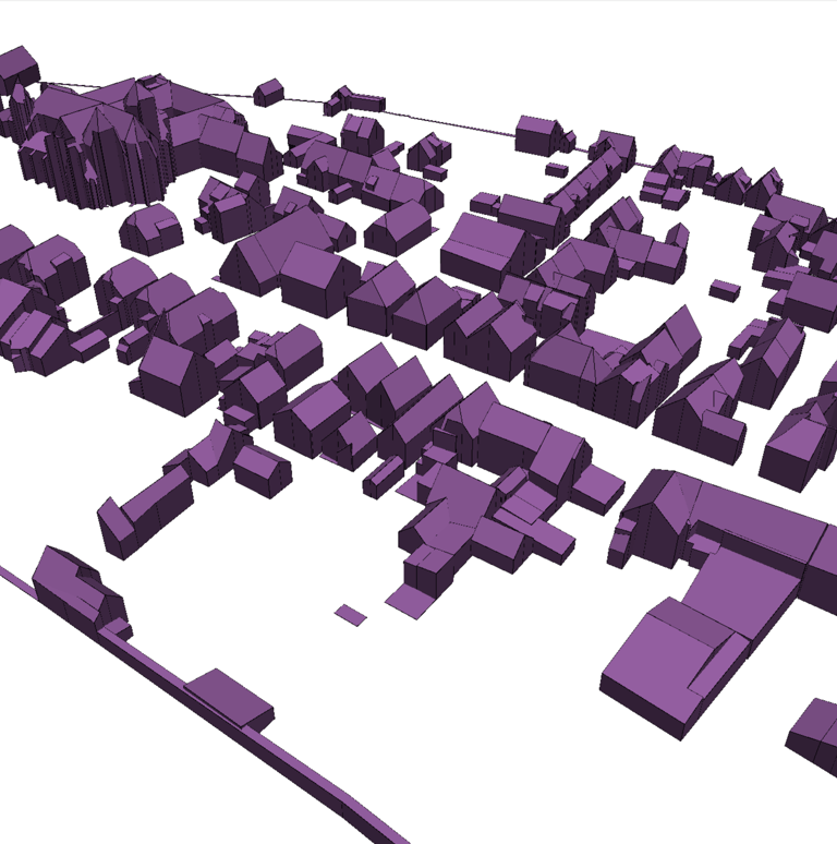
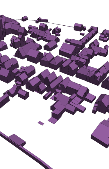
Point Cloud to 3D Model
Automatic 3D (LoD2.2) Reconstruction from Point Cloud
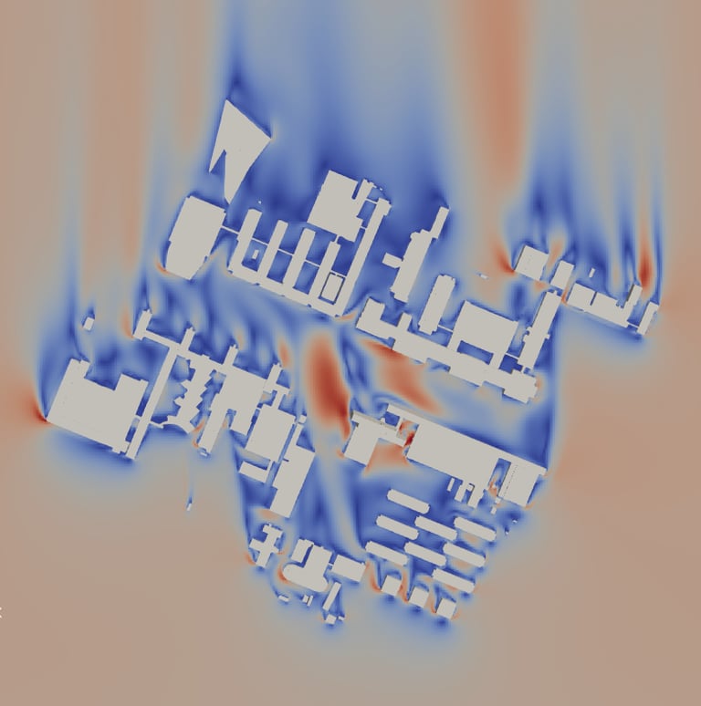
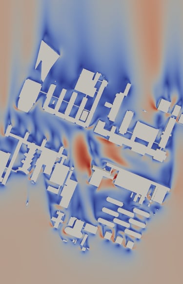
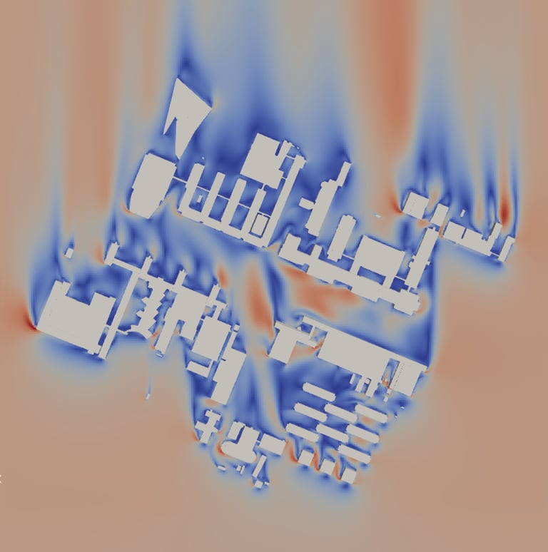
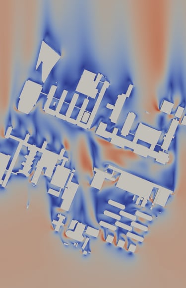
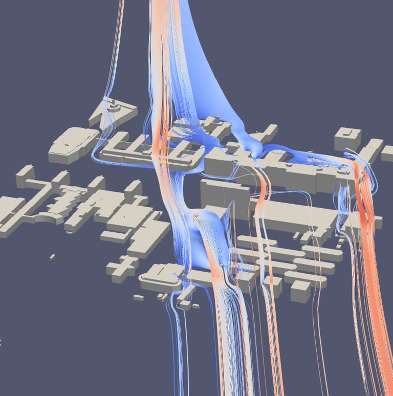
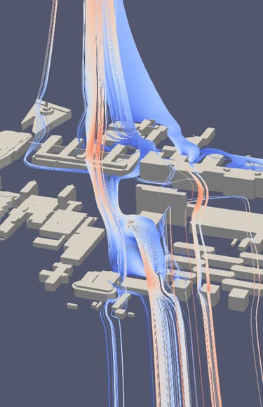
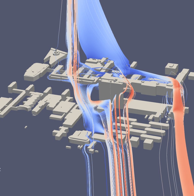
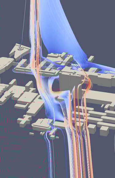
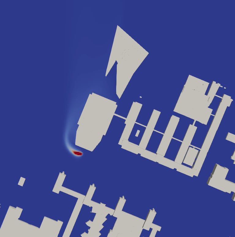
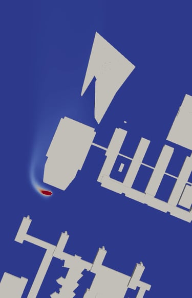
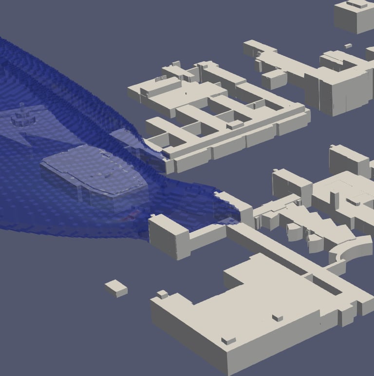
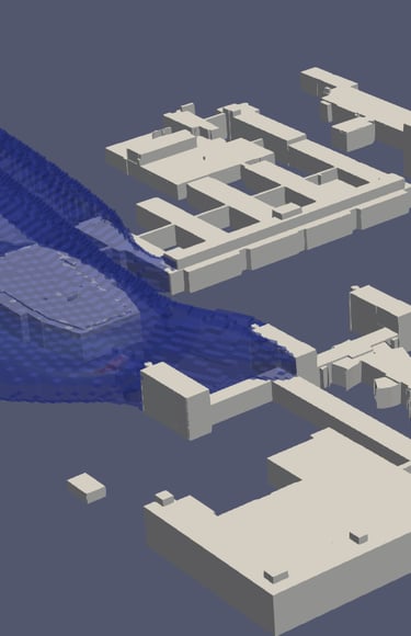
Using CFD, this turns complex urban aerodynamics into design decision support tools. We simulate pedestrian-level wind, turbulence, pressure and pollutant plumes for alternative massings, then help pinpoint how to reduce wind discomfort and accelerate dilution.
Test scenarios (heights, setbacks, screens, trees, corridors) before you build.
Identify hotspots and quantify Key Performance Indices e.g. at pedestrian level (wind speed, k, ε, concentration).
Compare A/B designs with maps, glyphs, streamtraces, and 3D plume visuals.
Get evidence-based guidance to optimize building form and public-realm comfort.
This work was carried out as part of a course project at TU Delft, integrating advanced research tools and methods into practical urban modelling applications.
Urban Wind and Pollution Dispersion Modelling
How Building Height Shapes Flow: Streamlines and Wind Speed Maps
Pollutant Dispersion Plume
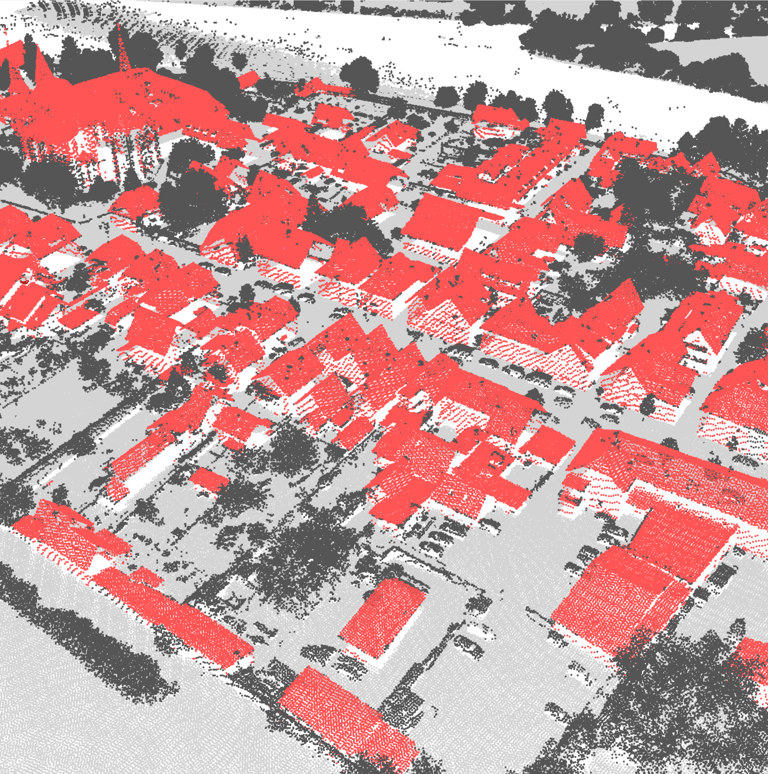
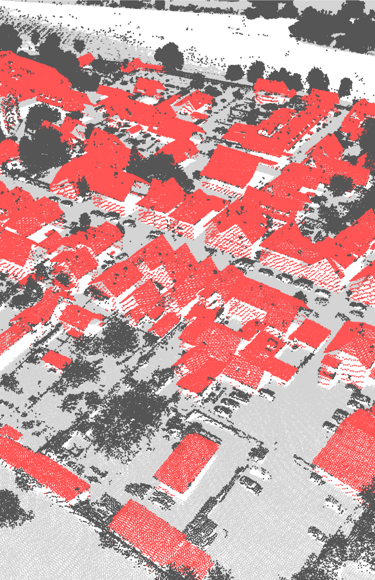
Point cloud data was processed to generate an accurate 3D surface model of the built environment. This produces a detailed and watertight model suitable for diverse applications.
The resulting 3D model can be imported into design and analysis platforms such as SketchUp, Revit, and Rhino, enabling integration with BIM workflows, architectural visualization, and environmental simulations.
This reconstruction provides a precise LoD2.2 model of the real-world geometry ideal for urban design, architectural context analysis, simulations, and environmental impact assessments.
The main 3D reconstruction algorithm applied for this kind of work was developed by researchers at TU Delft. Test data was downloaded from the Geoportal of Baden-Württemberg.
Automatic 3D Reconstruction from Point Cloud
Point cloud
Reconstructed model
Consulting
Expert GIS Solutions for Urban Design and Planning.
KvK: 94578486
Rotterdam NL
contact
info@urbispatium.com
© 2025. All rights reserved.